King George Corridor
Review the land use plan and development strategy for King George Boulevard in South Surrey.
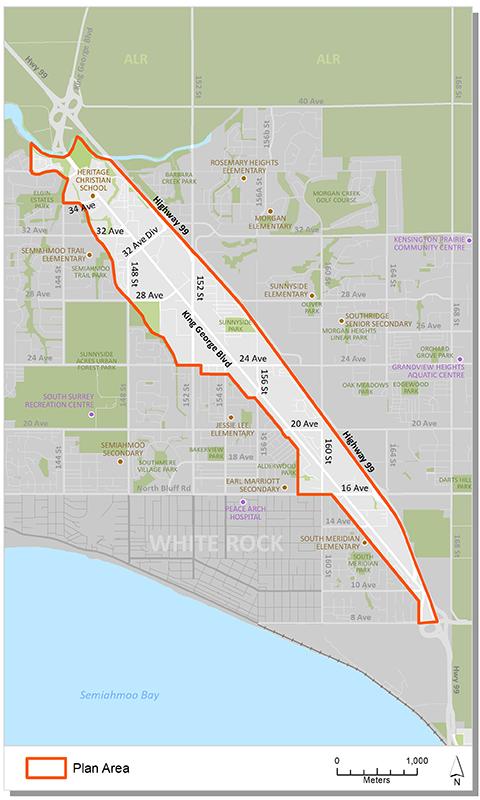
The King George Corridor is a large plan area that spans King George Boulevard from 8 Avenue to the Nicomekl River. The planning process, completed in 1995, resulted in the development of a land use and development concept plan.
This plan provides direction on:
- the type and density of development,
- location of parks and trails,
- transportation network; and,
- engineering infrastructure for the corridor.
Update
On December 2, 2024, Council endorsed Corporate Report R246 which updated land use designations to reflect current market conditions and reduce the need for reoccurring plan amendments.
Plan area
The study area is centered on King George Boulevard. It is bordered by Highway 99 to the east, the Nicomekl River to the north and 8th Avenue to the south. The corridor is approximately 7 kms long. It encompasses approximately 490 hectares (1,210 acres).

Background information
In 1995 City Council endorsed a land use concept plan for the King George Corridor. The development of this plan followed a brief review of land uses along the corridor and established a vision for the future growth of the corridor.
Key documents
Contact information
Planning & Development
planningdevelopment@surrey.ca
604-591-4448
Are you considering developing or rezoning? The first step is a Pre-Application Meeting.

