Historic Maps & Plans
Chart the history of Surrey with the maps and plans housed at the Surrey Archives.
The Surrey Archives' collection contains thousands of maps, architectural plans and technical drawings. These resources can help you chart the development of the city, explore pioneer settlements or investigate land use patterns over time. Highlights from this collection include pre-emption maps that note the names of pioneer property owners and early road maps that feature the original names of Surrey's roads.
If you are looking for current maps of Surrey, use the City of Surrey's Mapping Online System (COSMOS).
For more information, contact staff at archives@surrey.ca or 604-502-6459.
-

1892 Pre-Emption Map Southern Portion
1892 Pre-Emption Map Southern Portion
-
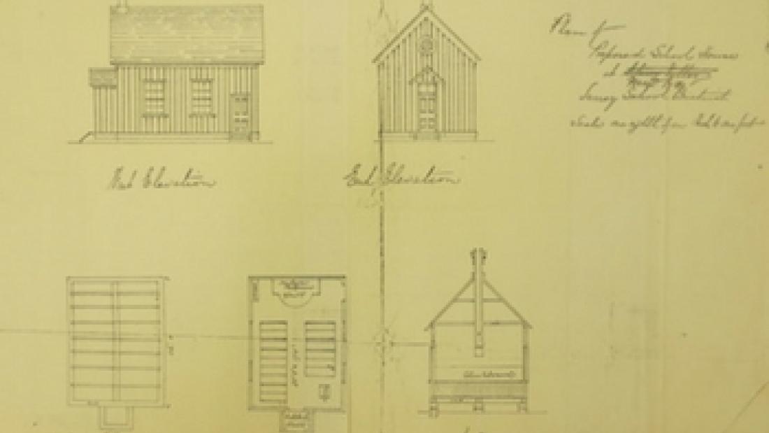
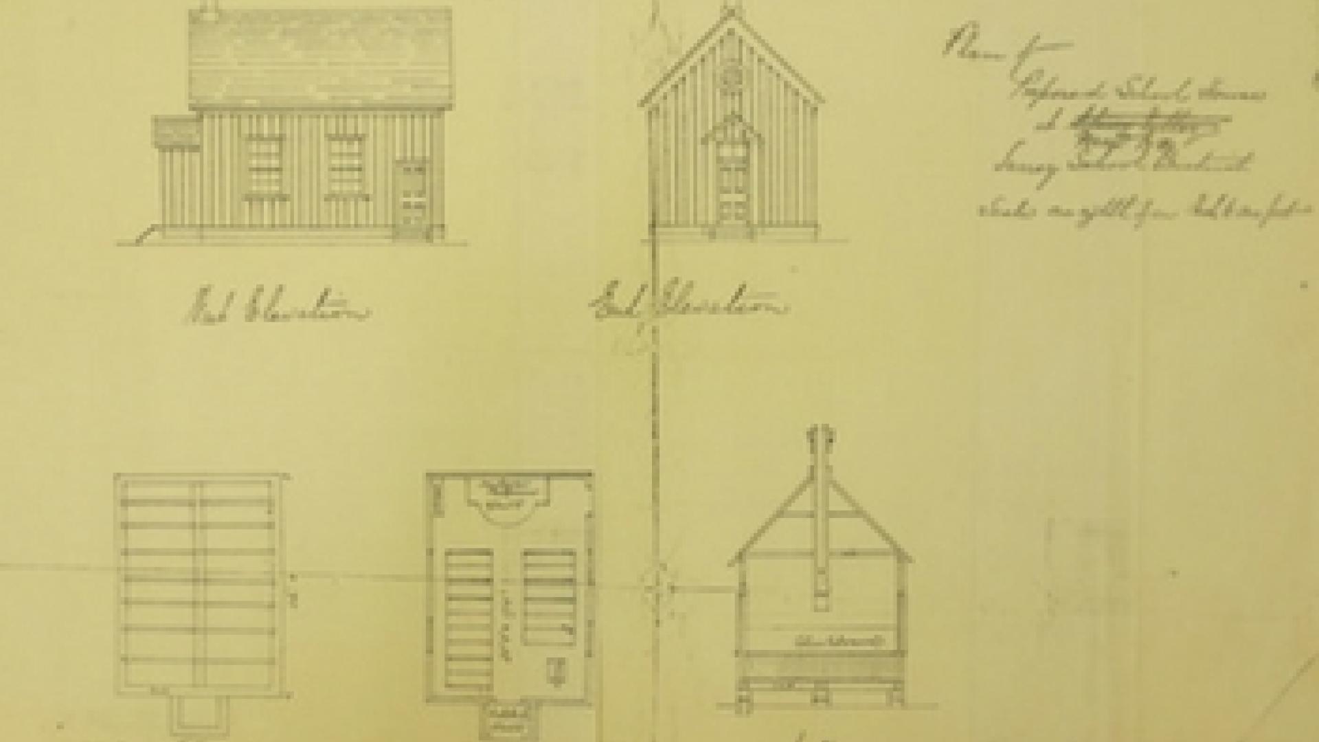
Plan of the Mud Bay School, 1883
Plan of the Mud Bay School, 1883
-

1910 Pre-Emption Map, Southern Half
1910 Pre-Emption Map, Southern Half
-

Southern Half of the 1923 Zoning Map
Southern Half of the 1923 Zoning Map
-
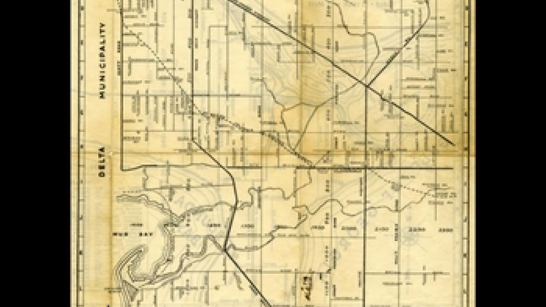
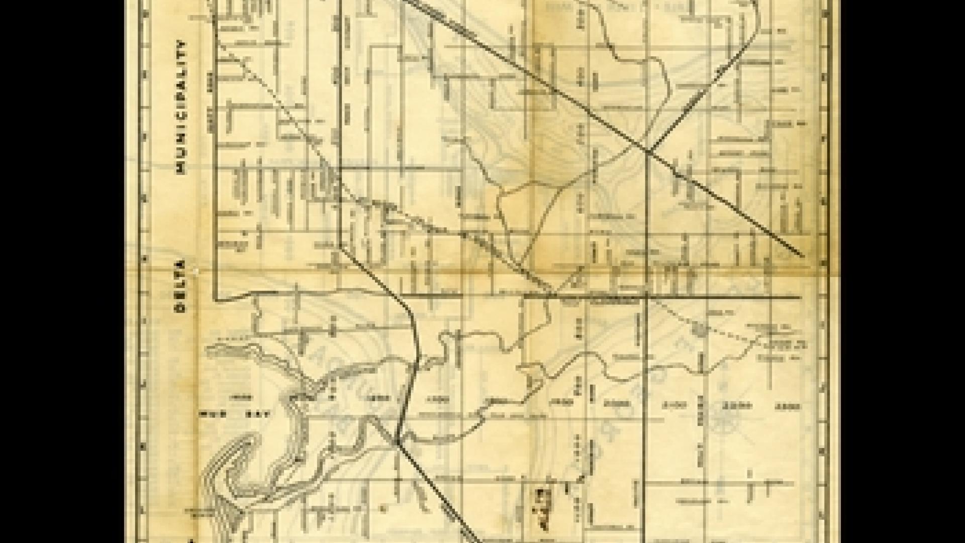
1938 Surrey Road Map
1938 Surrey Road Map
-

A 1938 Surrey road map
A 1938 Surrey road map
-

1959 Land Use Map
1959 Land Use Map
-

1973 Preliminary Control Plan
1973 Preliminary Control Plan