Serpentine & Nicomekl Lowlands
Have a say on irrigation needs in your community!
Agricultural Irrigation Feasibility Study
We are conducting an Agricultural Irrigation Feasibility Study to explore the potential for a non-potable irrigation water supply system in the Serpentine and Nicomekl floodplain.
The study will explore the feasibility of alternative water sources to help address increasing water demands due to climate change and support the long-term viability of agriculture in the area.
Through this study, the City aims to evaluate current and future irrigation demands, assess environmental and water quality considerations, and determine the economic, technical, and regulatory feasibility of a potential irrigation system that meets the region’s evolving needs.
As part of this work, input from local farmers and landowners is essential to ensure the study reflects the current available irrigation water and future irrigation needs.
We invite all agricultural producers and landowners in the Serpentine and Nicomekl lowlands to complete the survey. Your input will help inform our irrigation feasibility study. Survey closes May 30.
About Serpentine & Nicomekl Lowlands
The Nicomekl and Serpentine Rivers catchment area is 334 km2 of which 59 km2 is considered part of the lowland floodplain area for the river. Tributary areas to the Serpentine River include Guildford & Newton Town Centers, North West Langley, Port Kells, Bear Creek, Hyland Creek and Clayton Hill areas.
The river is controlled by sea dams located at King George Highway. Tributary areas to the Nicomekl River include City of Langley, Willowbrook Center in the Township of Langley, Cloverdale Town Center, Elgin creek, McLellan Creek, Barbara creek and Anderson Creek.
The river is controlled by sea dams located just south of King George Boulevard off Elgin Road. These dams consist of gates which open when tides are low to allow fresh water to flow to Mud Bay. When tides are high, the gates prevent brackish (salt water) from migrating up the river into farm land.
Much of the land within both river lowland areas is very close to sea level as it historically was an intertidal zone.
History of the Serpentine & Nicomekl Lowlands
In the late 1800s, farmers in the area began reclaiming the land for agricultural purposes through the installation of dykes and canals.
In 1910, the Surrey Dyking District was formed under the Drainage, Ditch, and Dike Act with a mandate to construct sea dams on both the Serpentine and Nicomekl Rivers.
Dyking of the Serpentine and Nicomekl rivers originally starting in the 1920s, it wasn’t until the late 1950s and the acquisition of a drag line that mechanized dredging along the both rivers became a regular project. Dredging was completed to build up the dykes, and remove silt.
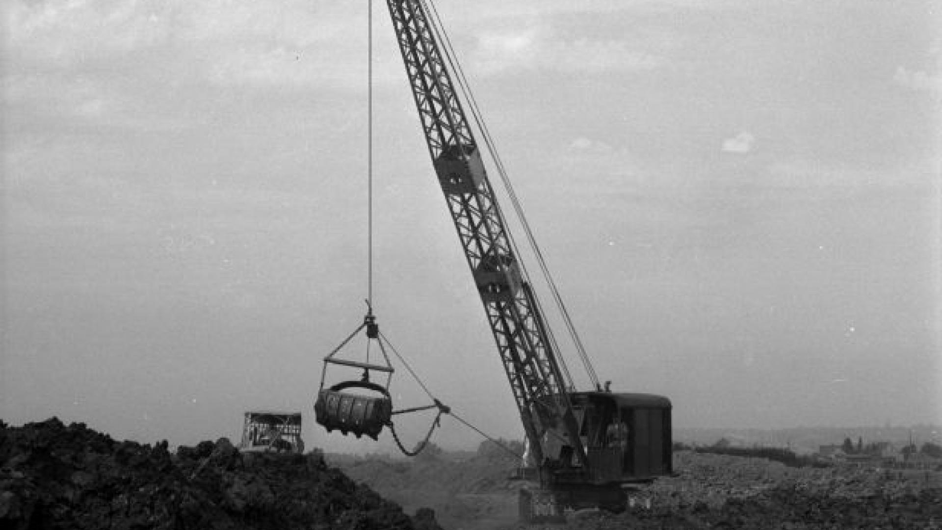
Dragline working on Nicomekl and Serpentine Rivers . Courtesy of Surrey Archives.
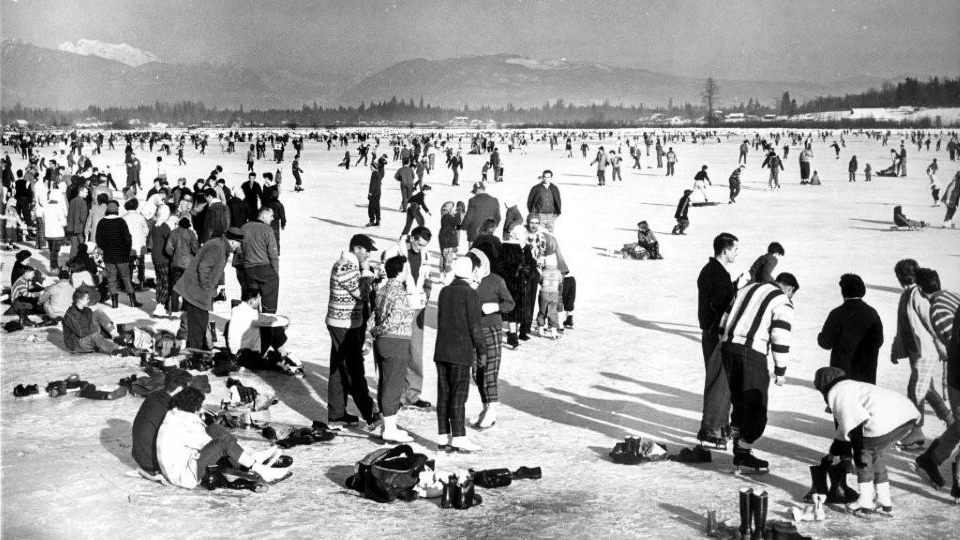
As Surrey developed, and despite the many efforts of the local farming community and the Surrey Dyking District, significant flooding continued, as can seen in the below picture of Serpentine floodplain in 1962.
Initially, logging activities resulted in complaints about the increased frequency and duration of flooding. Following logging, development resulted in further flooding complaints. In response to these complaints, the City initiated the development of the Strategic Plan for Lowlands Flood Control starting in 1994.
In 1997, the City embarked on an ambitious program to address lowland flooding. Through this plan, the City has implemented the Full Dyke strategy and has been actively planning, designing, and constructing dykes, pump stations, and conveyance improvements within the agricultural lowlands of the Serpentine and Nicomekl Rivers.
The original implementation schedule was expected to take 10-years and cost $40 million. Since implementing the Lowland Flood Control Strategic Plan in 1997, flooding in the Nicomekl and Serpentine floodplain has been significantly reduced.